TENERIFE Island
THE Island of explorers and pensioners

Tourist, geographic and geological, Tenerife can be divided into 5 main areas:
The Teno mountains in the west (red) - The Anaga mountains in the east (black) - The green north - The Teide central area - and the "spooky rest", say tourist castles and Party Stations to the west and south, with the Medano beach as Windsurfer / kite center
GO AROUND
A RENTAL CAR is STRONGLY recommended for traveling from the airport and visiting the islands!
Good car rental company: autoreisen.com
The bus system is quite well developed, but the next stop is 1.8 km from my finca, with a height difference of 200 m!
The CLIMATE
JUST GREAT! ^^
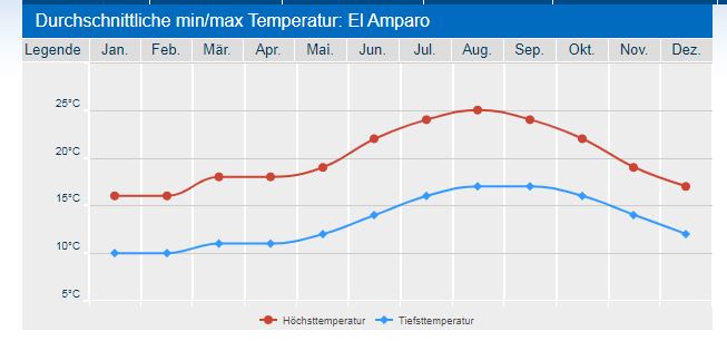
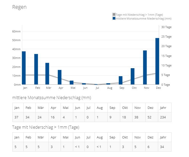
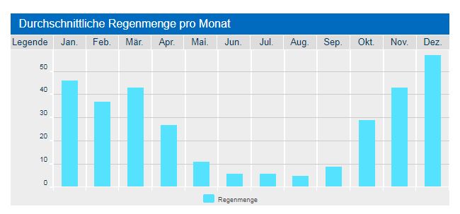
The climate on Tenerife varies a lot! The south coast is warmer and the north cooler and wetter!
In addition, ..depending on the altitude it gets colder !! Do not forget, on average, makes every 100 m height - 1 degree temperature!
My Finca at 625 m altitude is always 6.5 degrees COOLER as "down to the sea" and much wetter!
Therefore here also 2 climate tables: a) of Puerto de la Cruz (north by the sea) and "El Amparo" (but is still 150 m "below" my Finca)
The BEST website for climate check at my Coordinate is :
https://www.meteoblue.com/en/weather/week/28.35N-16.702E623_Atlantic%2FCanary

Useful Coordinates
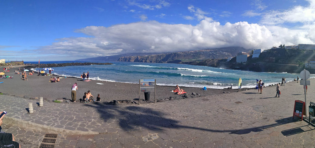
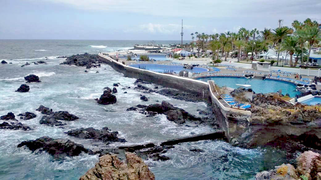
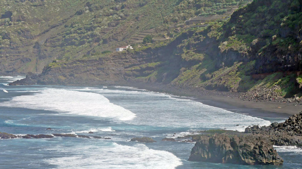
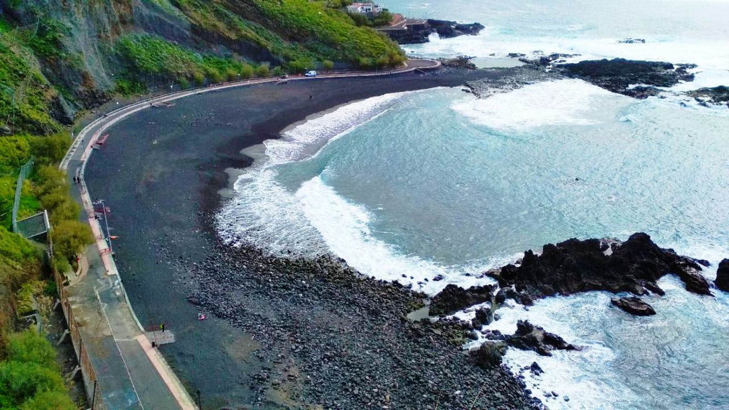
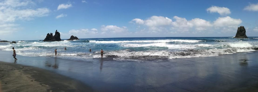
Northcoast
Socorro Beach und Cafe
https://goo.gl/maps/vymSs6jJwDR2
Pool ("Lago Martianez") in Puerto Cruz
https://goo.gl/maps/UdKPw6hPmkF2
Garachico Beach
https://goo.gl/maps/2788NtLo2r52
San Marocs Beach
https://goo.gl/maps/Rf4P9mVXSfD2
Picknick Area Arenas Negras:
https://goo.gl/maps/jAnz8ewv4aN2
..and the Chinyero
https://goo.gl/maps/f9t9y32DCip
Ausflugziel auf dem Weg zu Teide, "Caldera"
https://goo.gl/maps/ufNnBAv8z2B2
Recommended Restaurants:
https://canary-vibes.com/beste-restaurants-norden-teneriffa/
Restaurants near by the Finca:
La Taberna (400 m) : https://goo.gl/maps/MRZAMjK2pqbwfiE69
Restaurante Pescados La Barca (1,9 km) : https://goo.gl/maps/JME5neXjz9RiNFN56
Restaurante los Faroles (2,7 km also MONDAY opent!): https://goo.gl/maps/AqfSM43AYc2QAAL19
LA PARADA CASA DE COMIDAS (Center Icod, 5,5 km) ): https://goo.gl/maps/mnp2gDKjLkCxSZWx7
Nice Fish Restaurants close to the Ocean (in "Las Aguas):
" El Sotano" 11,5 km (open only from 13-17.00 but VARY by season!)
https://goo.gl/maps/Tr6uGW2F6Ju
Restaurante La Escuela (near by El Sotano) open 12.30-20.00, MON+TUE closed!
https://goo.gl/maps/ZWtEfuJBis9uiXay7
Pharmacy - Farmacia El Amparo Heriberto Ruiz (2,8 km)
Mo-Fri 8.00-20.30 - Sa 8.00-13.30 - Sun closed:
https://goo.gl/maps/sPmc1TepsiiThhu67
Post:
Mo-Fr: 8.30 .14.30 Sa: 9.30-13.00
https://goo.gl/maps/HAJsmJi1ciRZJBRB9
West and Eastcoast:
Masca
https://goo.gl/maps/qhrotJK6Szx
Anaga Mountain
https://goo.gl/maps/rxxjLyZwvtk
Supermarkets:
El Amparo (most close my Finca)
https://goo.gl/maps/WE3mJH5pFjo
Icod:
Mercadona und Hiperdino in Icod
https://goo.gl/maps/8f7Ccy9ZGb92
Lidl Realejos
https://goo.gl/maps/3tttBH4yUr42
Lidl Puerto Cruz
https://goo.gl/maps/bD7hRXmdqFn
Einkaufszentrum Puerto (Nähe Lidl)
https://goo.gl/maps/GQX1suR15i72
Recommended Car Rental:
autoreisen.com
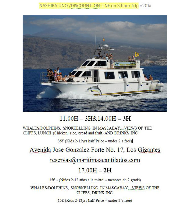
Whale Watching (3 h -28 Euro-online booking):
reservas@maritimaacantilados.com
Avenida Jose Gonzalez Forte No. 17, Los Gigantes
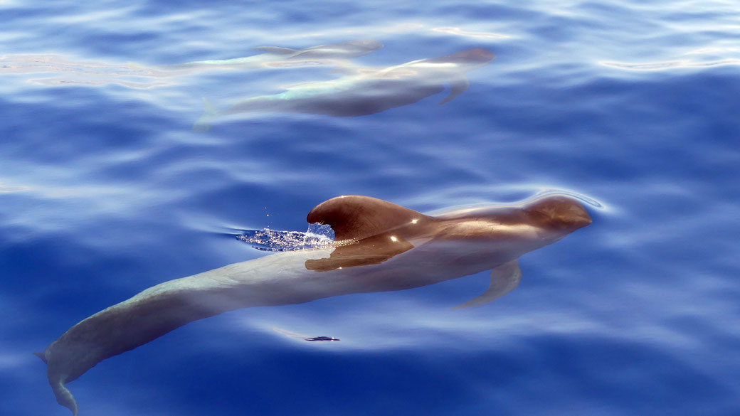
Whale Watching
Pilotwaale AND DOlphineS


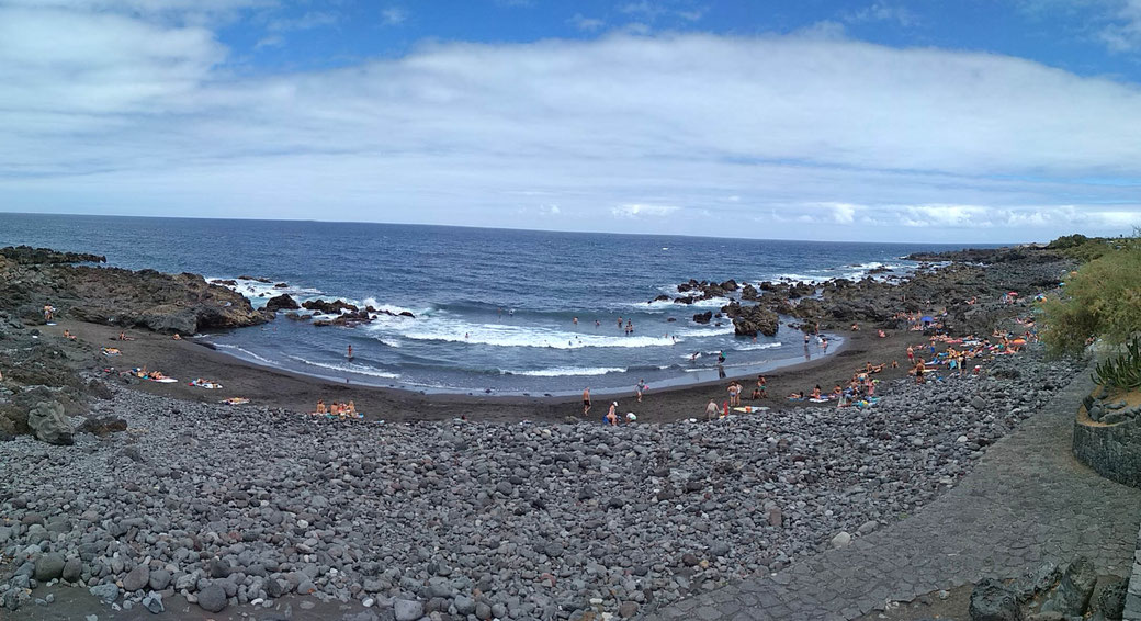
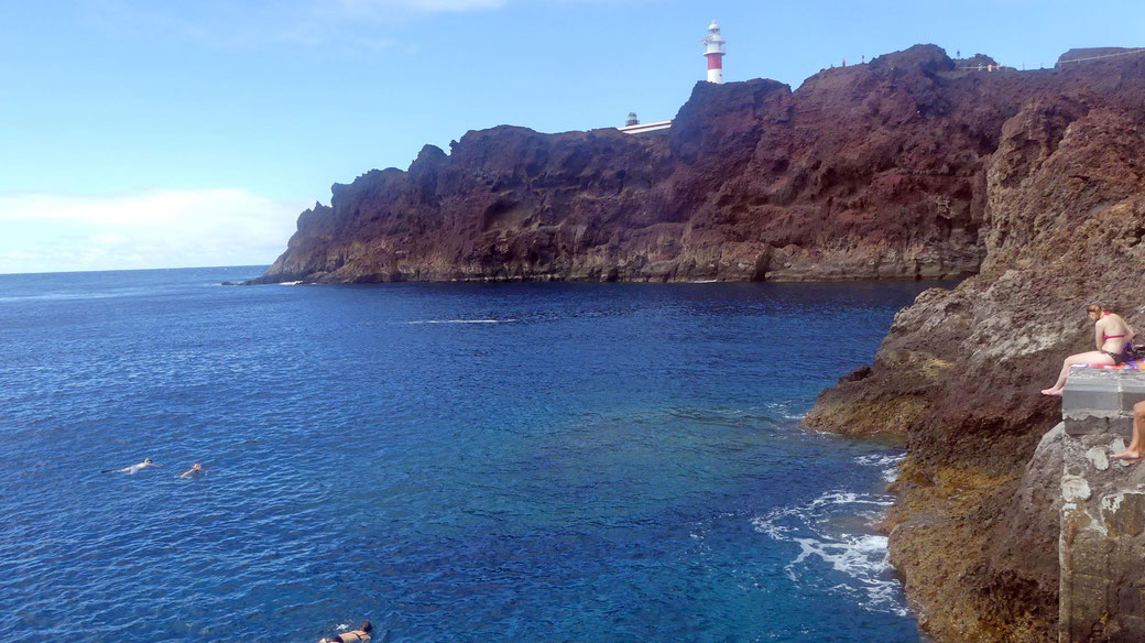
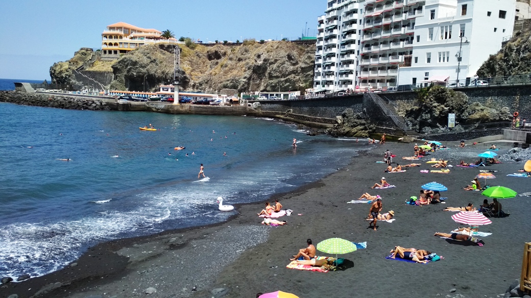
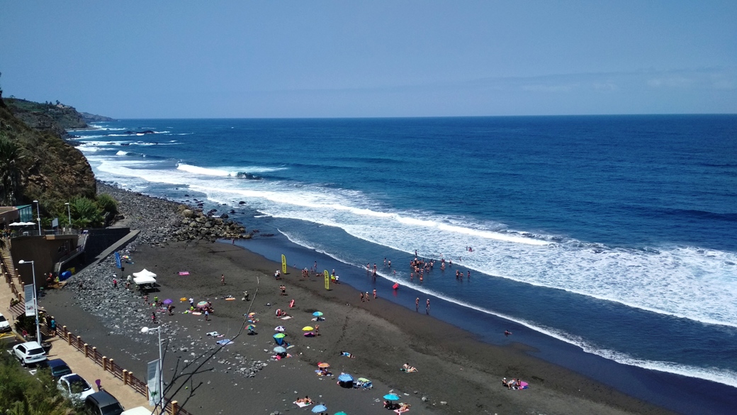
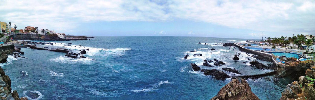
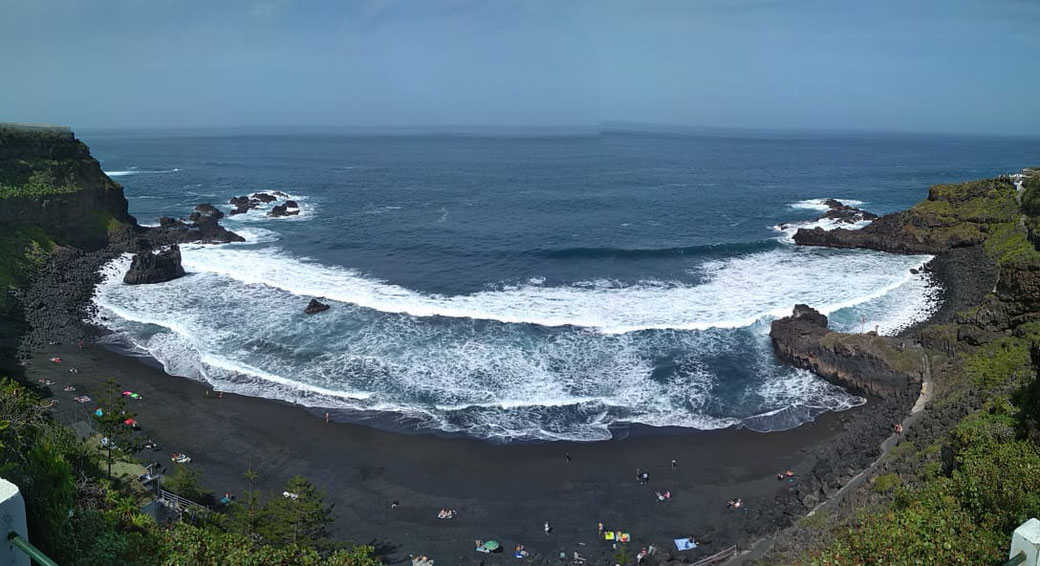
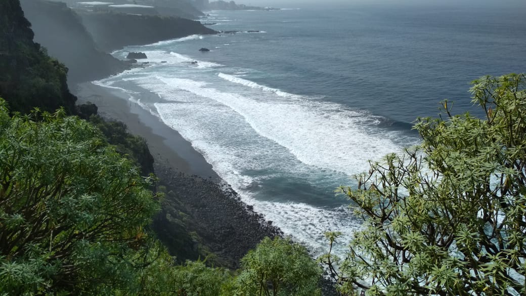
Beaches
NorthCoast
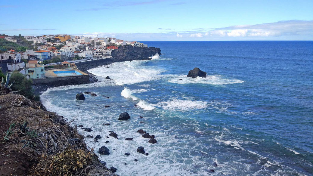
Hiking
The north, just behind my finca
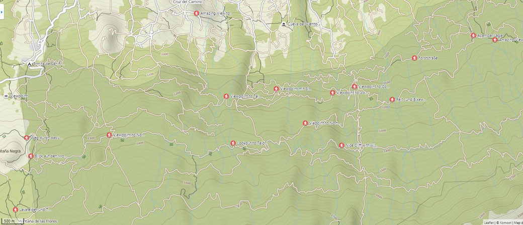
It's best to hike with a hiking app! Eg Komoot (Dt and En): https://www.komoot.com/discover
There I saved many public tours! Paths that are not even on the cards and nice round trips, in the area of my finca. My nick is "mchaco"
Here some nice links for walks:
a short 3,5 km evening walk : https://www.komoot.com/tour/54347143?ref=wtd
A nice 5km roundwalk from teh cave around my finca: https://www.komoot.com/tour/54347002?ref=wtd
My "new" 5.5 km Eve Walk: https://www.komoot.com/tour/55640138?ref=wtd
My Standard 6.5 km Walk: https://www.komoot.com/tour/55854946?ref=wtd
Just another 6.5 km: https://www.komoot.com/tour/55640094?ref=wtd
8,5 km around the Cave : https://www.komoot.com/tour/54340740?ref=wtd-m
From my Finca to the neighboring village (Cruce los caminos) and back: https://www.komoot.com/tour/54820486?ref=wtd
From my Finca to the neighboring village (Cruce los caminos) and back: https://www.komoot.com/tour/54820486?ref=wtd
From my Finca 8.5 km loopwalk : https://www.komoot.de/tour/106179430?ref=wtd
From my Finca 9 km Round Hike 650 m up: https://www.komoot.de/tour/104381700?ref=wtd
From my Finca 15 km (750 m slope) "Teide Test walk": https://www.komoot.de/tour/56899658?ref=wtd
Nice 6.5 km round walk above Montañeta: https://www.komoot.de/tour/95771045?ref=wtd
A 12 km walk : https://www.komoot.com/tour/55696488?ref=wtd
Up to the Icod Viewpoint: https://www.komoot.com/tour/52493368?ref=wtd
7 km nice roundwalk: https://www.komoot.com/tour/51789872?ref=wtd
The ancient Guanche trek: https://www.komoot.com/tour/55485201?ref=wtd
The connection path between 3.to .th line : https://www.komoot.com/tour/55225403?ref=wtd
My favorite Walk in AGUAMANSA (Orotava Valley):https://www.komoot.de/tour/46696533?ref=wtd
A quite nice 9 km roundwalk in Arenas Negras: https://www.komoot.com/tour/52991328?ref=wtd
A Walk around Montana Negra: https://www.komoot.com/tour/39300251?ref=wtd
The Chinyero Walk: https://www.komoot.com/tour/28345491?ref=wtd:
Day Trips
take your time, hang out and drive carefully!
The Nort-West Coast (Garachico, Buenavista, Punto Teno y Masca) - 90 km
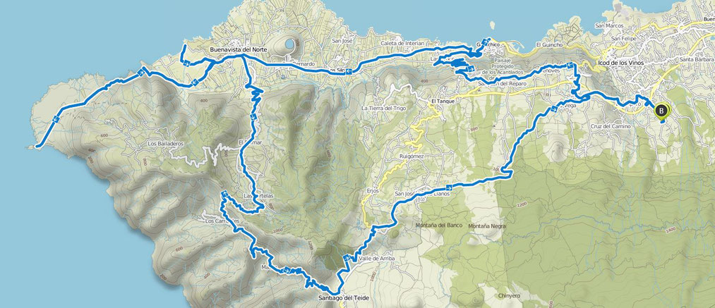
Komoot Tour: https://www.komoot.com/tour/55917183?ref=wtd
Puerto and the NORTH COAST (Hip-Beach: socorro) - 65 km
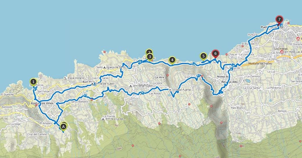
Komoot Tour: https://www.komoot.com/tour/55925884?ref=wtd
Central Tour around the Teide (La GUANCHA, icod alto, aguamansa, el portillo, Teide NP)-130 km
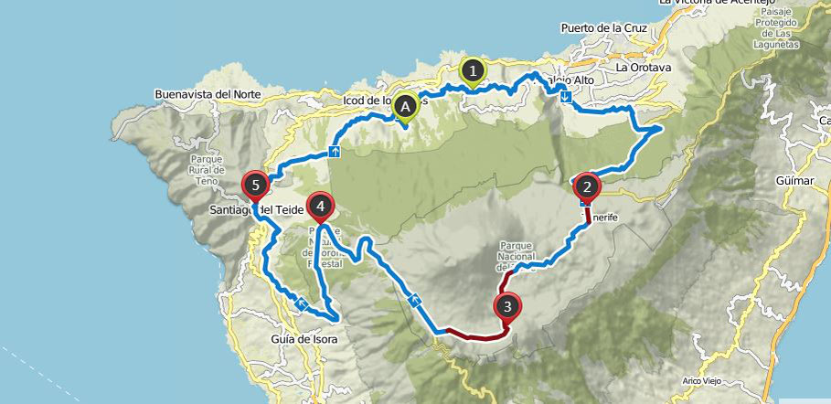
Komoot tour: https://www.komoot.com/tour/55923810?ref=wtd
City and Hiking Tour: La Laguna and punto hidalgo (130km)
https://www.komoot.com/tour/55924757?ref=wtd
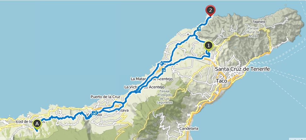
City Tour St Cruz, the hip-beach "Las Teresitas" and Anaga mountains (165 km)
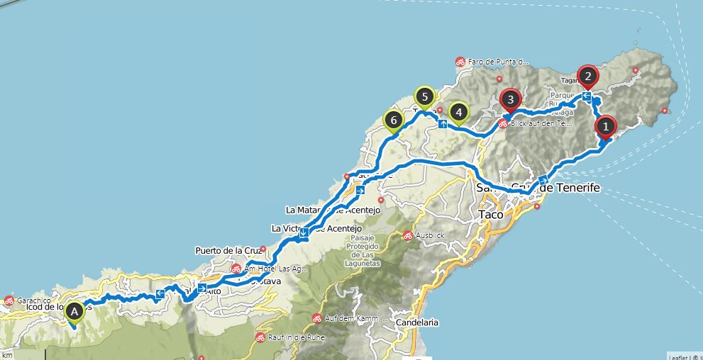
https://www.komoot.com/tour/55925064?ref=wtd
Los Gigantes (whale Watching) and hip beach "El medano" (180 km)
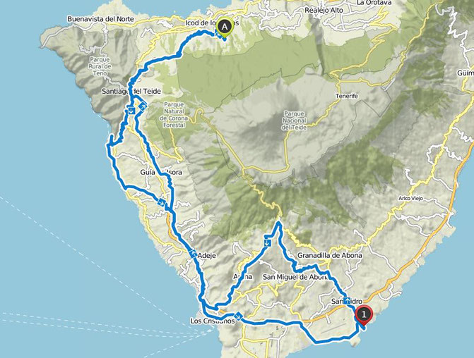
https://www.komoot.com/tour/55925315?ref=wtd
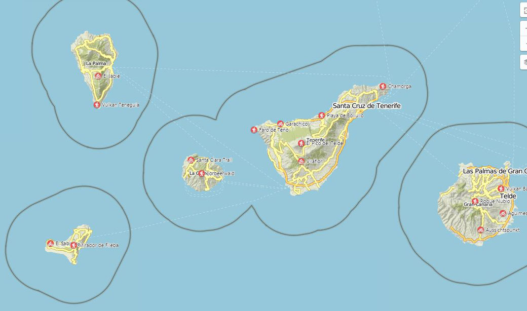
La Gomera, La Palma, EL HIERRO Or Gran Canaria
Geology
The age of Tenerife is estimated at around "only" 16 million years. The island initially consisted of various land masses, which have grown together only by further eruptions. The Teno Mountains, the southern part of Tenerife around Adeje / Valle de San Lorenzo and the Anaga Mountains originally separate islands. In a second major phase of volcanic activity, the Cumbre Dorsal emerged. This mighty, up to 2400 m high ridge stretches from the Cañadas to the high plateau of La Laguna and forms as it were the geological backbone of Tenerife. Around this time, a huge natural spectacle took place: In the area of today's Pico del Teide, a huge volcanic massif rose from the sea under violent embers and ash eruptions. Later, when the cone collapsed, the event left behind a volcanic crater about 16 kilometers across, which today forms the landscape of the Cañadas.
In a third major phase of volcanism, a massive volcanic cone with several side chimneys rose from this giant crater through repeated eruptions - the Pico del Teide, which "welded" the two mountain ranges together as one island. The Teide is thus much younger than the Urgebirge, only 4-7 million years old.
Until recently, there were smaller volcanic eruptions on Tenerife. The last volcanic eruption took place in 1909 near Santiago del Teide; the glowing lava masses came to a halt just outside the village.
Tektonic

The Canaries were probably created from a "hotspot" volcanism, so a static, hot magma chamber in the underground "burns" like a Bunsen burner "holes" (= volcanism) in the over him drifting Atlantic plate, similar to the Hawaiian Islands.
This hotspot volcanism is relatively calm and harmless, has little and only weak earthquakes, but you never know .... ^^
